


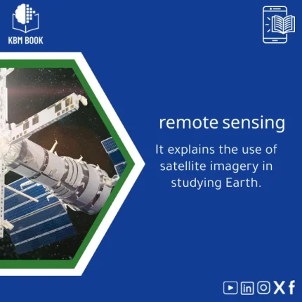
Remote Sensing Book for Earth Studies and Satellite Imagery
Original price was: 179.00 $.139.00 $Current price is: 139.00 $.
A structured, searchable Remote Sensing book presented as a Knowledge Base Module (KBM) that converts satellite imagery theory and practical workflows into step-by-step digital references — built for students, researchers, and professionals who need fast, reliable access to Earth studies knowledge.
Key benefits & value for students, researchers, and professionals
The Remote Sensing book is not a traditional textbook — it is a KBM: a layered, searchable knowledge database that reduces time-to-answer and increases reproducibility. Instead of long narrative chapters, each topic is broken into atomic entries: definitions, equations, workflows, scripts, example datasets, and annotated references. This structure delivers measurable value:
- Speed: Find the exact algorithm or parameter for an analysis in seconds with indexed entries and tags.
- Practicality: Directly deploy sample code and parameter sets in QGIS, SNAP, or Python (rasterio, GDAL, Google Earth Engine snippets included).
- Reliability: Each entry cites sources, typical error ranges, and quality checks so you can justify methods in reports or theses.
- Scalability: Move from classroom examples to regional or national studies using the documented scaling guidelines and pre-tested workflows.
Use cases & real-life scenarios
Student thesis or coursework
Use the KBM to assemble a reproducible methods section: sensor selection, preprocessing steps (atmospheric correction, geometric alignment), and supervised classification parameters. Export a compact bibliography for your dissertation.
Research projects
Researchers save time with ready-made scripts for change detection, time-series filtering, and accuracy assessment. Example: run a Sentinel-2 NDVI trend analysis across 10 years with a validated cloud-masking routine and confidence intervals pre-configured.
Professional consulting & reporting
Consultants can generate client-ready maps faster by following documented end-to-end workflows: input requirements, processing steps, error bars, and deliverable templates (maps, charts, metadata).
Who is this product for?
The Remote Sensing book is designed for:
- Undergraduate and graduate students needing structured material for coursework and theses.
- Academic and industry researchers requiring reproducible methods and quick access to spectral indices, sensors, and processing routines.
- Environmental consultants, GIS analysts, and policy advisors who must deliver validated maps and reports on timelines.
How to choose the right KBM version
The product is offered in modular variants so you can pick based on depth and file compatibility:
- Core (introductory): Conceptual summaries, essential formulas, basic workflows, PDF export — ideal for students.
- Standard (research-ready): Full workflows, code snippets (Python, GEE), sample datasets, and metadata templates.
- Pro (professional): All Standard content plus commercial sensor notes, advanced scripts, automation templates, and priority updates for teams.
Choose by the complexity of your projects: if your work includes multi-sensor integration or regional models, opt for Standard or Pro.
Quick comparison with typical alternatives
Compared to textbooks, scattered articles, or online tutorials, this Remote Sensing book (KBM) offers:
- Faster lookup: Indexed, searchable entries vs. linear chapters.
- Practical code & parameters: Ready to run instead of theoretical pseudocode.
- Less redundancy: Concise, curated content avoids repetitive background found across many articles.
Best practices & tips to get maximum value
- Integrate KBM entries into your version control (Git) so methods evolve with your project.
- Start with a short pilot: run one example workflow end-to-end to understand inputs and outputs.
- Use the included annotated bibliographies when you need to justify methodological choices.
- Customize parameter presets for local conditions but keep a copy of original KBM entries for reproducibility.
Common mistakes when choosing or using remote sensing resources — and how to avoid them
- Buying a generic resource: Avoid materials that lack sensor-specific guidance — this KBM separates sensor modules and preprocessing recipes.
- Ignoring metadata: The KBM highlights how to read and preserve metadata; never work with imagery without verifying acquisition details.
- Skipping validation: Many users forget accuracy assessment; the KBM includes standard validation protocols and confidence reporting templates.
Product specifications
- Format: Knowledge Base Module (exportable to PDF, JSON, CSV with linked code files)
- Modules: Sensors, Preprocessing, Indices, Classification, Time-series, Case Studies
- Included code: Python (rasterio, numpy), Google Earth Engine snippets, QGIS processing models
- Languages: English (primary content); selected Arabic summaries for key sections
- Compatibility: Works with common GIS and data tools (QGIS, SNAP, GEE, Python 3.8+)
- Delivery: Instant digital download with versioned updates (per license)
- Usage notes: Single-user and team licensing options available; redistribution restricted per license
Frequently asked questions
Is this Remote Sensing book available as a PDF or only as a KBM?
The KBM is delivered in multiple export formats: searchable KBM files for interactive use, downloadable PDF summaries for offline reading, and JSON/CSV for integration with other tools. Choose the format that fits your workflow.
Can I use the included scripts in commercial projects?
Yes — licensing options include commercial use. The standard single-user license permits internal commercial use; for redistribution or multi-user deployment choose the Pro or team license. Licensing details are provided at checkout.
How often is the content updated to reflect new sensors or methods?
Core modules receive scheduled updates and Pro licenses include priority updates. Each update includes a changelog and version number so you can track method changes for reproducibility.
I’m new to remote sensing — is this book too advanced?
No. The KBM is layered: introductory entries explain core concepts; intermediate and advanced entries provide detailed workflows and code. You can start with the Core version and upgrade as needed.
Ready to accelerate your remote sensing work?
Reduce time spent searching for methods and increase reproducibility in your projects. The Remote Sensing book KBM provides practical, validated workflows and immediate access to the tools you need.
Related products
Astronomy Observational Techniques Guide for Celestial Motion
Astrophysics Book: Understanding Stars, Galaxies, and Dark Energy
A searchable, hierarchical Knowledge Base Module (KBM) that converts astrophysics and cosmology into a practical, exam-ready and research-ready reference. Designed for students, researchers, and professionals who need immediate access to reliable explanations, equations, and data models for stars, galaxies, and dark energy.
Atomic Physics Guide: Understanding Atomic and Electron Properties
Knowledge Base — Atomic/Electron Properties & Electromagnetic Interactions. A structured, searchable KBM for students, researchers, and professionals who need an authoritative atomic physics reference that organizes concepts, formulas, experiments, and practical applications from basics of atomic physics to advanced electron properties.
Comprehensive Evolutionary Biology Book on Natural Selection
Comprehensive Nuclear Physics Book on Structure and Radioactivity
General and Special Relativity Book on Einstein’s Theory
A structured, searchable Knowledge Base Module (KBM) that converts Einstein's General and Special Relativity into a clear, hierarchical reference: formulas, derivations, worked examples, practical applications (GPS, astrophysics), and a compact research bibliography — ready to download and integrate into study, teaching, or research workflows.
Reviews
Clear filtersThere are no reviews yet.