


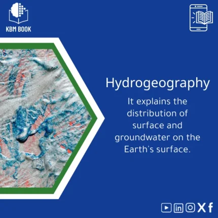
Hydrological Geography Guide to Surface and Groundwater Resources
Original price was: 179.00 $.139.00 $Current price is: 139.00 $.
A ready-to-use, hierarchically organized Knowledge Base Module (KBM) that maps the distribution of surface and groundwater resources, providing students, researchers, and professionals with a searchable, structured reference for rapid decision-making and study.
Key benefits & value for the buyer
The Hydrological Geography KBM translates scattered hydrology literature and datasets into a single, coherent knowledge structure. It saves time, reduces duplication, and increases confidence in the results you cite or apply.
Features translated into outcomes
- Hierarchical taxonomy: Navigate from high-level concepts (water balance, recharge zones) down to procedural steps (sample collection, recharge estimation).
- Practical datasets: Ready-to-use data layers and standardized attribute schemas accelerate GIS analysis and field planning.
- Reproducible methods: Step-by-step methodology blocks with citations let you reproduce or adapt analyses for academic or consultancy work.
- Export-ready summaries: Save time on writing literature reviews or method sections for thesis chapters and reports.
Use cases & real-life scenarios
Concrete examples of how the Hydrological Geography KBM is used day-to-day:
- University field course: Instructors use the KBM to prepare lecture packets, field checklists, and GIS shapefiles showing local recharge areas.
- Research literature review: PhD candidates extract standardized citations and methodological templates to compare groundwater modelling approaches.
- Environmental consultancy: Practitioners import the KBM’s data schema into project GIS to speed up baseline assessments for water resources planning.
- Policy briefing: Analysts produce concise, evidence-backed briefings on surface vs. groundwater availability for decision-makers using the KBM summaries.
Who is this product for?
This KBM is designed specifically for students, researchers, and professionals who need reliable, structured access to hydrological knowledge:
- Undergraduate and graduate students seeking a compact, authoritative hydrological geography book alternative.
- Researchers needing consistent datasets and reproducible methods for modeling surface and groundwater distribution.
- Environmental engineers and water resource managers who require quick access to mapped recharge areas, aquifer properties, and monitoring protocols.
How to choose the right format & version
The KBM is available in multiple delivery formats. Choose based on how you work:
- Student / reader: PDF + markdown summary — ideal for study and citation in coursework.
- Researcher / analyst: Full package — CSV/GeoJSON layers, metadata, and method blocks for direct import into GIS and analysis tools.
- Professional / consultant: Enterprise bundle — includes onboarding notes, presentation-ready slides, and tailored export options for reports.
Each format lists included files and licensing in the product download page so you can confirm compatibility before purchase.
Quick comparison with typical alternatives
Compared with textbooks, journal articles, or raw datasets, the Hydrological Geography KBM is structured for speed and application:
- Textbooks: Deep narrative but not machine-readable; KBM provides both narrative and structured data.
- Journal papers: Focused on single studies; KBM synthesizes multiple sources and standardizes methods.
- Raw datasets: Provide numbers but no structured taxonomy or reproducible method templates; KBM packages both data and guidance.
Best practices & tips to get maximum value
- Start with the hierarchical index: identify topic nodes you need (e.g., recharge estimation) and export only relevant layers.
- Use the provided metadata to align layer projections and units before analysis.
- Adopt the KBM’s method templates for your methods section to ensure reproducibility and consistent citations.
- Regularly check the KBM update log (included) to refresh datasets or corrected entries.
Common mistakes when buying/using similar knowledge products — and how to avoid them
- Buying raw data only: Without method notes you’ll spend time reformatting—choose the KBM for data + structure.
- Ignoring metadata: Unit mismatches and projection errors are common; follow KBM metadata first.
- Assuming coverage is global: Check spatial extent in the specifications; the KBM documents regional coverage per layer.
Product specifications
- Title: Hydrological Geography Guide to Surface and Groundwater Resources
- Category: Earth & Environmental Sciences Section
- Formats included: PDF summary, Markdown KBM, CSV, GeoJSON, JSON metadata
- Spatial coverage: Global framework + regional example datasets (see dataset index in download)
- Languages: English (primary); translation-ready structure
- Licensing: Single-user research license; enterprise options available
- Usage notes: Citation block and methodology templates included for academic use
FAQ
Does this KBM replace a hydrology textbook?
What formats are provided and will they work with my GIS?
How current are the datasets and references?
What if I only need a small portion of the KBM?
Ready to access structured hydrological knowledge?
Download a KBM designed to shorten literature reviews, accelerate GIS work, and make field planning predictable and reproducible. Purchase includes clear licensing and all file formats listed above.
Related products
Atomic Physics Guide: Understanding Atomic and Electron Properties
Knowledge Base — Atomic/Electron Properties & Electromagnetic Interactions. A structured, searchable KBM for students, researchers, and professionals who need an authoritative atomic physics reference that organizes concepts, formulas, experiments, and practical applications from basics of atomic physics to advanced electron properties.
Cell Biology Guide: Structure, Division, and Transport Insights
Cosmology Book: Guide to Big Bang and Galaxy Evolution
Electromagnetism Book: A Comprehensive Guide to Fields and Circuits
General Physics Book: Fundamentals of Force, Motion, Energy
Molecular Biology Guide: Transcription, Translation & Repair
Physical Chemistry Guide: Energy, Thermodynamics & Interactions
A structured Knowledge Base Module (KBM) for Physical Chemistry that converts core theory, worked examples, and applied datasets into a searchable, hierarchical database — ideal for students, researchers, and professionals who need fast, reliable access to chemical thermodynamics basics and molecular interaction models.

Reviews
Clear filtersThere are no reviews yet.