


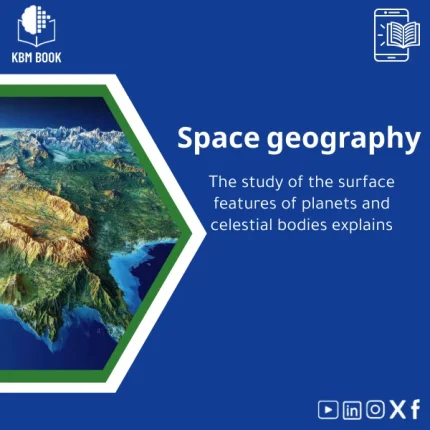
Space Geography: Guide to Planetary Surface Topography
Original price was: 179.00 $.139.00 $Current price is: 139.00 $.
A structured, searchable Knowledge Base Module (KBM) that converts planetary surface topography and terrain studies into a hierarchical, ready-to-use digital reference — designed for students, researchers, and professionals who need fast, reliable access to planetary geography facts, maps, and analytical methods.
Key benefits & value for the buyer
This Space Geography KBM converts scattered planetary terrain knowledge into a compact, standardized database you can query, cite, and build upon. Instead of piecing together charts, papers, and raw datasets, get a single source that:
- Reduces research time: structured taxonomy and pre-built filters let you find features (craters, rilles, escarpments) and their metrics in seconds.
- Improves reproducibility: CSV and JSON exports preserve the exact datasets and metadata used in examples and case studies.
- Supports teaching and exams: instructor-ready modules and concise topic outlines map to course objectives.
- Facilitates mission planning & analysis: terrain metrics and slope distributions included for basic landing-site screening and hazard assessment.
Every entry in the KBM includes provenance links, measurement methods, and cross-references — making each fact auditable and practical for professional work.
Use cases & real-life scenarios
For a graduate student
Use the KBM to extract a vetted list of references and elevation statistics for a thesis chapter on Martian valley networks. Export CSV tables to create plots and include reproducible methodology in the methods section.
For a planetary geologist
Rapidly compare morphometric properties across tectonic provinces and download standardized datasets for cross-validation with remote sensing products.
For an instructor
Assemble a lab exercise: students run the provided scripts on sample DEMs, compute slope and roughness metrics, and interpret landing-site safety using KBM-supplied thresholds.
Who is this product for?
- Undergraduate and graduate students in planetary science, geology, and astronomy who need compact references and datasets.
- Researchers requiring quick access to standardized terrain metrics and provenance for comparative studies.
- Data analysts and mission engineers seeking pre-validated examples for terrain assessment workflows.
- Instructors and trainers looking for ready-to-use course modules and reproducible lab materials.
How to choose the right format and edition
This is a digital KBM; pick the package that fits your workflow:
- Student Pack (PDF + example datasets): concise chapters, figures, and classroom-ready exercises — best for coursework and quick study.
- Research Pack (PDF + CSV + JSON + scripts): full dataset exports, metadata, and Jupyter-compatible examples — for reproducible research.
- Institutional Pack (multi-user license): includes instructor notes and classroom licenses suitable for departmental use.
Consider your primary toolchain (Excel, GIS, Python) when choosing formats. If you need API-ready data, select the Research Pack.
Quick comparison with typical alternatives
Compared with traditional textbooks or scattered journal articles, this KBM is:
- More searchable — hierarchical indexing vs. linear chapters.
- More actionable — includes datasets and scripts, not just prose.
- Faster to integrate — exports for common data tools replace manual digitization.
If you need a narrative-driven textbook for broad reading, a conventional book may suffice. If you need structured data, repeatable methods, and quick lookups, this KBM is the better fit.
Best practices & tips to get maximum value
- Start with the taxonomy chapter to align your terminology with the KBM’s controlled vocabulary.
- Use provided example scripts as templates — modify them for your DEM resolution and planetary body.
- Always check provenance links for underlying datasets before citing in publications.
- Keep the KBM’s metadata files with your project to ensure reproducibility during peer review.
Common mistakes when using similar resources and how to avoid them
- Mixing inconsistent units: The KBM standardizes units; ignore this and you’ll get invalid comparisons. Always convert to the KBM’s canonical units first.
- Overlooking metadata: Using datasets without provenance leads to unverifiable results. Read the metadata and methods included in each module.
- Assuming one-size-fits-all thresholds: Terrain hazard criteria vary by body and mission profile — use the KBM guidance rather than generic cutoffs.
Product specifications
- Title: Space Geography: Guide to Planetary Surface Topography
- Format: PDF (full text), CSV (tabular data), JSON (structured KB), example Jupyter/Python scripts
- Size: ~120 pages equivalent; primary dataset exports ~25 MB (compressed)
- Structure: Hierarchical taxonomy → topic modules → datasets → examples → references
- Languages: English (primary). Arabic metadata and summaries available in select modules.
- License: Single-user, research, and institutional licensing options available
- Compatibility: Works with any text reader; CSV/JSON compatible with Excel, QGIS, Python, R
- Updates: Versioned updates and errata provided for 12 months from purchase; extended update plans available
Frequently asked questions
Which formats are included and will they work with my tools?
We provide PDF for reading and teaching, CSV and JSON for data analysis, and example scripts for Python/Jupyter. CSV opens in Excel and QGIS; JSON is suited to programmatic workflows. Choose the Research Pack if you require the full data suite.
Are the datasets and methods citable and sourced?
Yes. Each dataset entry includes provenance, measurement methods, and a recommended citation. The KBM consolidates peer-reviewed sources and established remote-sensing products; source links and DOIs are included where available.
How are updates handled and is support available?
Purchases include 12 months of versioned updates and a changelog. Support for installation, data import, and classroom setup is provided via KBMBook support channels. Institutional packs include priority support.
Can I use this KBM in a classroom or for commercial projects?
Licensing varies by pack. Single-user purchases permit academic and research use. Institutional and commercial licenses are available—contact KBMBook for terms that allow distribution to students or incorporation into paid services.
Ready to make planetary terrain knowledge work for you?
Choose the pack that matches your workflow and get immediate access to a structured, citation-ready Space Geography KBM that saves hours of research and prevents common data errors. Confident purchases include updates and clear licensing — see specifications above.
Need help deciding? Contact KBMBook support for a short consultation on which pack best fits your project before purchase.
Related products
Analytical Chemistry Book: Qualitative and Quantitative Methods Guide
Astrophysics Book: Understanding Stars, Galaxies, and Dark Energy
A searchable, hierarchical Knowledge Base Module (KBM) that converts astrophysics and cosmology into a practical, exam-ready and research-ready reference. Designed for students, researchers, and professionals who need immediate access to reliable explanations, equations, and data models for stars, galaxies, and dark energy.
Atomic Physics Guide: Understanding Atomic and Electron Properties
Knowledge Base — Atomic/Electron Properties & Electromagnetic Interactions. A structured, searchable KBM for students, researchers, and professionals who need an authoritative atomic physics reference that organizes concepts, formulas, experiments, and practical applications from basics of atomic physics to advanced electron properties.
Biochemistry Book: Understanding Chemical Processes in Living Systems
Comprehensive Nuclear Physics Book on Structure and Radioactivity
Electromagnetism Book: A Comprehensive Guide to Fields and Circuits
Inorganic Chemistry Guide: Bonding and Crystal Solids
A structured, searchable Knowledge Base Module (KBM) that converts inorganic chemistry fundamentals and advanced topics—bonding models, lattice structures, defects, and solid-state properties—into a practical digital reference for students, researchers, and professionals who need fast, reliable answers without wading through textbooks.
Modern Physics Book: Quantum, Relativity, and Tech Applications Guide
A structured, searchable Knowledge Base Module (KBM) that turns modern physics — quantum mechanics, special & general relativity, and contemporary technological applications — into a hierarchical, practical reference for students, researchers, and professionals who need quick, reliable access to advanced concepts and formulas.
Reviews
Clear filtersThere are no reviews yet.