


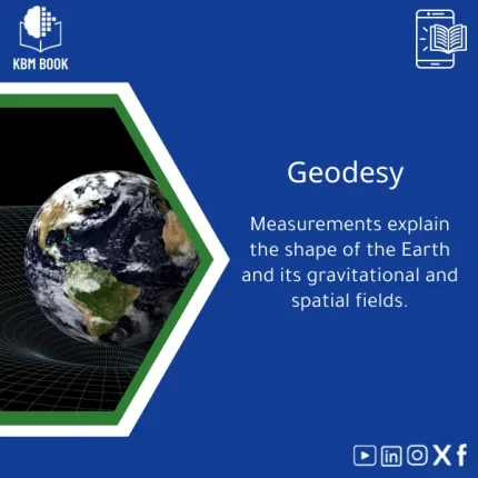
Geodetic Sciences Guide to Earth’s Shape and Gravity
Original price was: 199.00 $.159.00 $Current price is: 159.00 $.
A structured, searchable Knowledge Base Module (KBM) that converts geodetic theory and field practice into a hierarchical, practical reference for fast answers on Earth’s shape, gravity field, and spatial measurements — built for students, researchers, and professionals.
Key benefits & value for the buyer
The Geodetic Sciences KBM translates specialized knowledge into a compact, immediately usable digital reference. Each technical feature below is presented with the benefit it delivers:
Structured, hierarchical content
Benefit: Find the specific formula, dataset description, or processing step without reading full chapters. Useful for exam prep and field decisions.
Validated methods and worked examples
Benefit: Reduce trial-and-error — follow proven workflows for GNSS data cleaning, geoid modelling, or levelling corrections with sample inputs and expected outputs.
Multiple delivery formats
Benefit: Use the PDF for offline study and the interactive database for scripting, automation, or integration with GIS and processing tools.
Compact but deep
Benefit: Covers core theory (ellipsoid models, reference frames) and applied tasks (gravity anomaly estimation, datum transformation) without unnecessary repetition.
Use cases & real-life scenarios
Undergraduate and graduate coursework
Students use the KBM as a course companion: short summaries for lecture revision, annotated formulas for assignments, and curated problem sets for practice.
Research and thesis work
Researchers extract reproducible procedures for gravity field inversion, cite clear definitions of reference frames, and re-run sample analyses using attached datasets to verify methods.
Surveying and engineering projects
Surveyors and geospatial engineers follow checklists for field campaigns: instrument setup, GNSS baseline processing, and transformation to project datums — saving time and reducing rework.
Teaching and training
Instructors repurpose modular KBM sections into lab exercises and slide-ready diagrams — a faster way to prepare consistent, accurate training material.
Who is this product for?
This KBM is designed for:
- Students in geodesy, geophysics, and geomatics needing a concise geodesy textbook or geodesy textbook pdf alternative.
- Researchers who require a dependable, citable reference on earth shape measurements and gravity modelling.
- Professionals and engineers requiring quick, practical guidance on field procedures, data-processing pipelines, and quality-control checks.
- Trainers and consultants who prepare hands-on workshops and need modular, reusable content.
How to choose the right format, depth and license
KBMs are configurable. Choose based on how you work:
- Format — PDF only for reading/printing; PDF + JSON/CSV for scripting and integration.
- Depth level — Introductory (overview + examples) vs. Advanced (full derivations, code snippets, datasets).
- License — Single-user for personal study; Team/license for department use with redistribution rights.
- Language — English primary; check availability of Arabic annotations for selected sections.
Recommendation: Choose the PDF + interactive DB with Advanced depth if you plan to reuse content in research or teaching. Choose Single-user Introductory if you only need a concise geodesy textbook pdf for study.
Quick comparison with typical alternatives
How this KBM differs from a traditional textbook, scattered articles, or raw datasets:
- Textbook: Deep narrative and chapters — KBM is modular and searchable for immediate retrieval of facts and procedures.
- Journal articles: Focused discoveries — KBM organizes methods and background into a coherent, reusable toolkit.
- Raw datasets: Useful but opaque — KBM includes annotated datasets and processing steps so you can reproduce outcomes.
Best practices & tips to get maximum value
- Start with the indexed summary to map where procedures live; bookmark key entries for fast reference during labs or fieldwork.
- Use the included sample datasets to validate your processing environment before applying to field data.
- Integrate the JSON/CSV export with your pipeline to automate routine checks (baseline lengths, residual statistics, geoid height lookups).
- For teaching: extract module quizzes and worked problems to form consistent assessments across cohorts.
Common mistakes when buying or using geodetic references — and how to avoid them
- Mistake: Buying a long textbook expecting quick lookup. Fix: Choose a structured KBM for searchable entries.
- Mistake: Using undocumented datasets. Fix: Use KBM’s annotated sample data and follow the supplied workflows.
- Mistake: Overlooking license limits for team use. Fix: Select a team license when content will be redistributed in class or projects.
Product specifications
- Title: Geodetic Sciences Guide to Earth’s Shape and Gravity
- Primary keyword: Geodetic Sciences
- Formats: PDF (print-ready), JSON/CSV (interactive database)
- Depth levels: Introductory, Advanced
- Coverage: Reference frames, ellipsoids, GNSS processing, levelling, gravity field theory, geoid modelling, datum transformations
- Included materials: Worked examples, sample datasets, code snippets, bibliography
- Compatibility: GIS and scientific scripting environments (Python, R), standard PDF readers
- License options: Single-user, multi-user/team
- Delivery: Instant download after purchase from KBMBook
FAQ
Is this KBM the same as a geodesy textbook pdf?
Can I use the interactive files in my processing scripts?
What if I need departmental access?
How current are the methods and references?
Ready to accelerate your geodetic work?
Download a compact, reliable reference that saves time in the lab and field. Choose the format and license that match your workflow, then integrate the KBM into studies, research, or project pipelines.
Instant download | PDF + interactive database options | Team licenses available
Related products
Atomic Physics Guide: Understanding Atomic and Electron Properties
Knowledge Base — Atomic/Electron Properties & Electromagnetic Interactions. A structured, searchable KBM for students, researchers, and professionals who need an authoritative atomic physics reference that organizes concepts, formulas, experiments, and practical applications from basics of atomic physics to advanced electron properties.
Cell Biology Guide: Structure, Division, and Transport Insights
Comprehensive Evolutionary Biology Book on Natural Selection
General Biology Book: A Guide to Cells, Genetics & Taxonomy
Introductory General Chemistry Book on Matter and Reactions
A structured, searchable Knowledge Base Module (KBM) that converts core general chemistry concepts — matter, elements, reactions, stoichiometry and molarity — into a hierarchical reference you can query, teach from, or integrate into study workflows. Ideal as a concise General Chemistry book alternative for students, researchers, and professionals who need accurate, practical chemistry knowledge fast.
Materials Physics Guide: Understanding Solid-State Properties
Modern Physics Book: Quantum, Relativity, and Tech Applications Guide
A structured, searchable Knowledge Base Module (KBM) that turns modern physics — quantum mechanics, special & general relativity, and contemporary technological applications — into a hierarchical, practical reference for students, researchers, and professionals who need quick, reliable access to advanced concepts and formulas.

Reviews
Clear filtersThere are no reviews yet.